The highly anticipated NASA-ISRO Synthetic Aperture Radar (NISAR) mission is set for launch at 5.40 Pm IST today from Sriharikota, marking a groundbreaking collaboration between the Indian Space Research Organisation (ISRO) and the National Aeronautics and Space Administration (NASA). According to Mint, the Earth observation satellite is poised to transform how we monitor natural disasters, climate change, and ecosystem disturbances globally.
A Global Partnership in Space
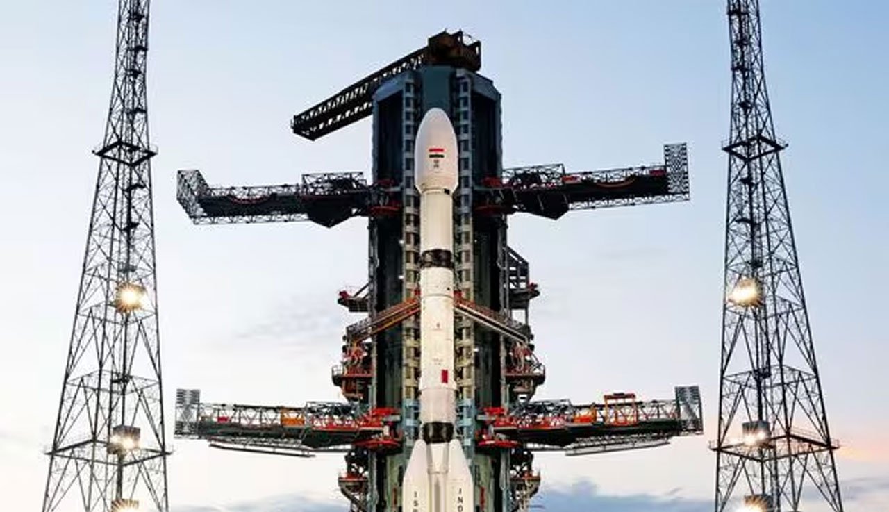
NISAR, the world’s first radar imaging satellite to use dual frequencies (L-band and S-band), is a flagship mission under the NASA-ISRO space partnership. It is designed to observe Earth’s land and ice surfaces with unprecedented accuracy and resolution. The satellite will be launched aboard ISRO’s GSLV Mk II from the Satish Dhawan Space Centre.
This mission combines NASA’s Jet Propulsion Laboratory (JPL) expertise with ISRO’s cutting-edge satellite and launch capabilities. NASA has provided the L-band SAR (Synthetic Aperture Radar), while ISRO has developed the S-band radar and will handle the satellite’s launch operations.
What Makes NISAR Unique
The satellite will orbit Earth every 12 days, mapping the entire globe and collecting data to monitor changes in land surfaces, including deforestation, glacier movements, soil moisture, and groundwater levels. This makes it a vital tool in tracking the long-term impacts of climate change, agricultural development, and natural hazards such as earthquakes, landslides, and floods.
NISAR’s dual-band technology gives it a unique edge over traditional Earth observation satellites. It can capture data regardless of cloud cover, weather conditions, or time of day – ensuring consistent, high-quality imaging around the globe.
Indian Innovation Takes Centre Stage
While NASA has developed some core components, the satellite’s final assembly and integration have been done in India. ISRO’s UR Rao Satellite Centre (URSC) in Bengaluru played a pivotal role in preparing NISAR for flight. The satellite was later transported to Sriharikota where final launch preparations are underway.
Officials from both agencies have described the mission as “a milestone in Indo-US space cooperation,” and NISAR is expected to remain operational for at least three years after launch.
Launch Window and What to Expect
While an exact launch date is yet to be publicly confirmed, sources indicate the satellite could be launched as early as later this year or early 2026. Once in orbit, NISAR will begin transmitting data that will be made available to scientists and policymakers across the globe.
Why This Matters
NISAR will enable real-time monitoring of Earth’s changing surface — crucial for disaster preparedness, agriculture, water resource management, and studying the effects of rising global temperatures. The data will be freely available, ensuring transparency and global collaboration in climate research.
This mission is not just a testament to technological prowess, but also a shining example of what international collaboration in science can achieve.
Photo Credit: Mint
For more spotlight stories click here
Follow us for latest updates: